Water & Earth observation
Exploring how satellite and spatial information can support water planning in arid environments, with attention to validation and uncertainty.
Read the recharge-screening preprint ↗SSRN · September 2026 · PreprintEARTH OBSERVATION · ENVIRONMENT · GIS
CEO & Co-founder · TerraQant
Connecting satellite observations
with environmental decisions.
Geospatial researcher and GIS practitioner exploring water intelligence, urban climate and environmental monitoring.
01 / ABOUT
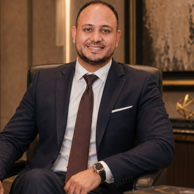
I work at the intersection of environmental research and the geographic information systems used in planning and operations.
I am the Chief Executive Officer and Co-founder of TerraQant, an artificial intelligence solutions company.
My PhD in Geography at Tanta University examined atmospheric dust concentrations in Egypt’s Western Desert, their variation over space and time, and future trends using remote sensing and GIS.
My research spans urban thermal environments, precipitation and climate-sensitive planning. Alongside this work, my professional experience includes imagery analysis, enterprise GIS, spatial databases and technical training.
PhD in Arts in Geography
Tanta University · First-Class Honor
MA in Geography
South Valley University · Excellent
BA in Arts, Geography and GIS
South Valley University · Very Good with Honors
02 / RESEARCH
Three connected directions, from climate processes to the information used in practice.
Exploring how satellite and spatial information can support water planning in arid environments, with attention to validation and uncertainty.
Read the recharge-screening preprint ↗SSRN · September 2026 · PreprintResearch on urban heat, thermal exposure and climate-sensitive planning, including ENVI-met modelling of mitigation strategies in Egyptian cities.
Read the HBRC Journal article ↗HBRC Journal · 2026Connecting environmental image analysis with spatial databases and GIS applications. Future work prioritizes reproducible evaluation and transfer across locations.
Read the research statement ↗Research direction · Read online or download PDFSELECTED FIGURES
Selected maps from co-authored research, with original legends and source attribution.
CAIRO · REMOTE SENSING
Night-time land-surface temperature anomalies (left) and their trends (right), 2003–2019. Temperature and trend panels use different units and scales.
Figures & publication ↗03 / PUBLICATIONS
Journal articles, book chapters and preprints, with links to their publication records.
11 outputs
Journal article
International Journal of Climatology 46(12), e70516
DOI: 10.1002/joc.70516
Journal article
Sustainability 18(15), 7926
DOI: 10.3390/su18157926
Preprint
SSRN, posted 30 Sep 2026
Preprint · not a peer-reviewed journal article.
DOI: 10.2139/ssrn.7545105
Journal article
HBRC Journal 22(1), Article 61
DOI: 10.65800/2090-9934.1060
Journal article
Sustainable Cities and Society 102, 105236
DOI: 10.1016/j.scs.2024.105236
Book chapter
Hydroclimatic Extremes in the Middle East and North Africa, pp. 299-323
DOI: 10.1016/B978-0-12-824130-1.00005-9
Book chapter
Hydroclimatic Extremes in the Middle East and North Africa, pp. 325-341
DOI: 10.1016/B978-0-12-824130-1.00015-1
Book chapter
Egypt’s Strategy to Meet the Sustainable Development Goals and Agenda 2030: Researchers’ Contributions, pp. 207-238
DOI: 10.1007/978-3-031-10676-7_13
Journal article
Environmental Pollution 288, 117802
DOI: 10.1016/j.envpol.2021.117802
Book chapter
Agro-Environmental Sustainability in MENA Regions, pp. 381-403
DOI: 10.1007/978-3-030-78574-1_17
Journal article
Remote Sensing 12(23), 3889
DOI: 10.3390/rs12233889
Night-time land-surface temperature anomalies (left) and their trends (right), 2003–2019. Temperature and trend panels use different units and scales.
Figure 6 · Published article
El Kenawy et al. (2020), Remote Sensing 12, 3889 ↗
CC BY 4.0
Minimum and maximum seasonal extent of the surface urban heat island over Greater Cairo, 2003–2019.
Figure 7 · Published article
El Kenawy et al. (2020), Remote Sensing 12, 3889 ↗
CC BY 4.0
No publications match. Try a different title or select all outputs.
The 2021 Aswan chapter uses the published author spelling Islam M. Jaber. Preprints are identified separately. This selection reflects records reviewed on 22 October 2026.
04 / PROJECTS
Selected assignments that connect spatial analysis, information management and practical use.
GIS consulting at Midtown, including deep-learning applications to waste detection, satellite and aerial image analysis, spatial database quality and training.
A water-planning GIS assignment through ATSS for Saudi Arabia’s Ministry of Environment, Water and Agriculture, in a data science analyst role.
An 88-day GIS engagement documented by CDM Smith, involving a multilayer GIS database, reporting and training for solid-waste work in Qena and Assiut.
WATER INFORMATION · DIGITAL PLATFORMS
Water Information Center platforms & dashboards
Established an enterprise geographic information system and developed water-information systems, with contributions spanning project management, implementation and development.
MY CONTRIBUTION
Project management · Implementation · Development
SELECTED SYSTEMS
INSTITUTIONAL RECOGNITION
The minister’s public statement highlighted the centre’s integrated digital environment, reliable data and indicators, and their contribution to water-resource planning and decision-making.
The statement recognizes the centre’s work collectively.Read the minister’s original post ↗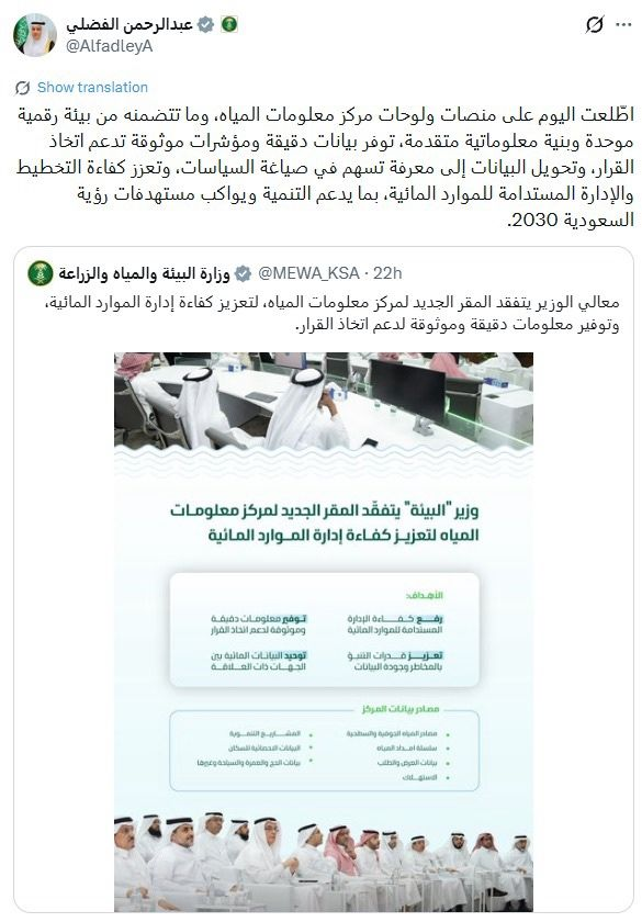
ENTERPRISE GIS · WATER INFORMATION CENTER
منظومة المعلومات الجغرافية المؤسسية — بوابة مركز معلومات المياه
MY CONTRIBUTION
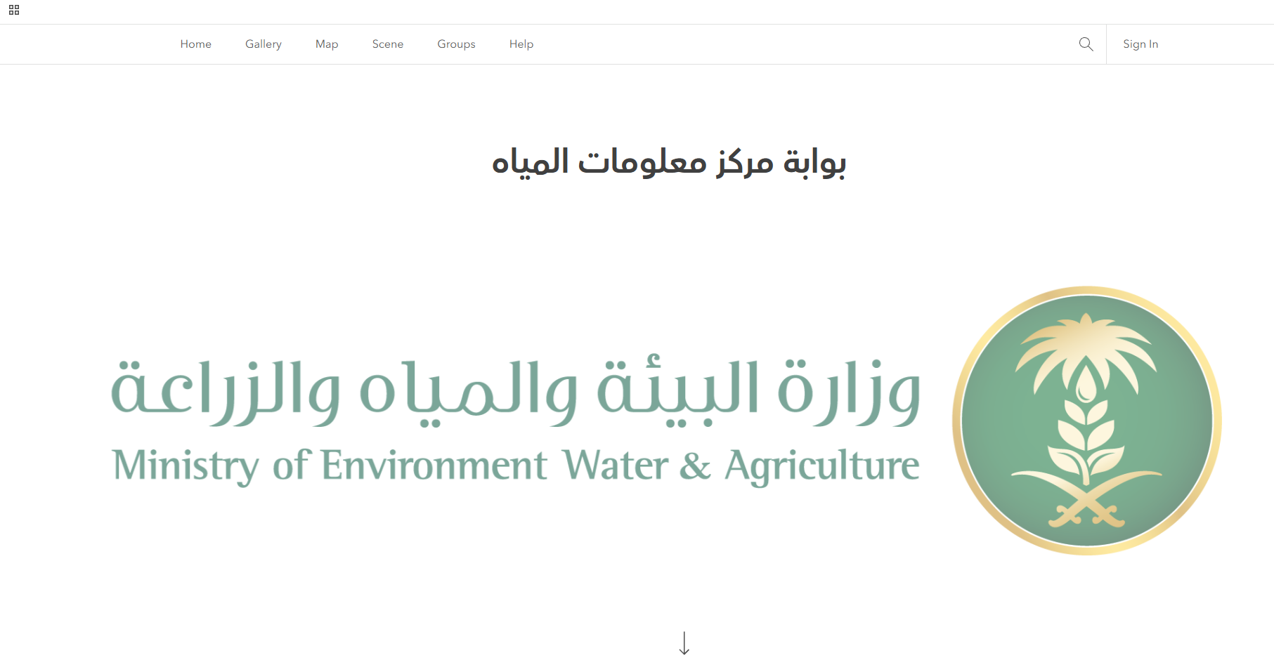
Established and developed the enterprise GIS system, with participation in project management and implementation.
PORTAL INTERFACE
The landing page presents a shared entry point to geospatial content, with navigation for a gallery, maps, scenes and groups.
Ministry of Environment, Water and Agriculture · Water Information Center
SELECTED APPLICATION · WATER SUPPLY
تطبيق الإمداد المائي
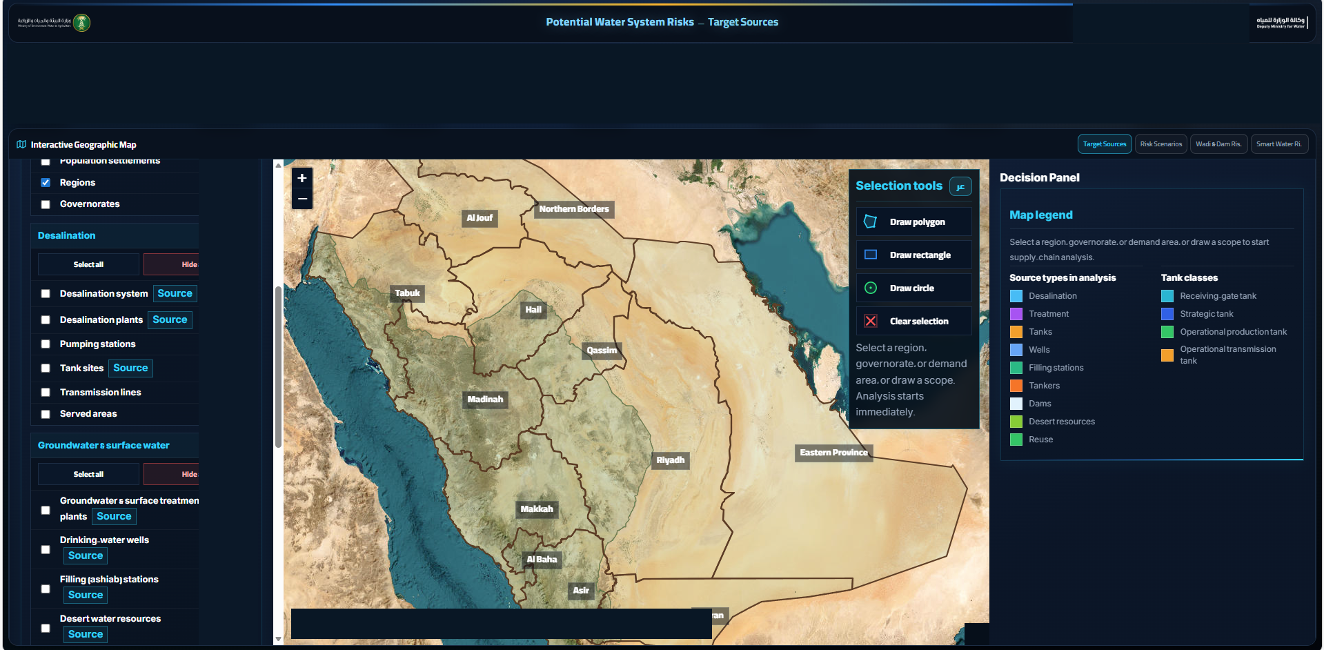
Operational figures redacted
MY CONTRIBUTION
System development, implementation and participation in project management.
INTERFACE HIGHLIGHTS
An interactive geographic map brings together water-source layers, region and area selection, and a decision panel for supply analysis.
05 / EXPERTISE
Remote sensing, spatial data analysis, urban climate and environmental imagery interpretation.
Enterprise GIS applications, integrated spatial databases, data quality and technical training.
Environmental research, interdisciplinary collaboration and project management supported by the PMP credential.
06 / PROFESSIONAL EXPERIENCE

ENTREPRENEURSHIP & LEADERSHIP
TerraQant
Artificial intelligence solutions
الرئيس التنفيذي والشريك المؤسس — تيراكانت لحلول الذكاء الاصطناعي
Commenced January 2024
ATSS · Client: MEWA
Senior Advanced Data Science Analyst, translated from the documented Arabic role title.
April 2023 – September 2024
Midtown
Environmental imagery, enterprise GIS applications, database quality and training.
September 2022 – January 2024
Telecom Egypt
Full-time GIS appointment.
January – December 2020
Al-Marasem
May 2017 – May 2019
IVECOM
07 / MEMBERSHIPS & SERVICE
Professional memberships, specialist registration and previous national committee service.

Professional membership
Geographic Information Systems Specialist
Specialist membership in Geographic Information Systems.
Expert registration
Registered Expert · Category D
Registered in Geographic Information Systems, and in training and conference activities.

Scientific committee service
Former Committee Member
Former member of the National Committee for Astronomy and Space Sciences.

Professional membership
PMI Member
Member of the Project Management Institute. PMP certification is listed separately below.
Organization marks identify the institutions listed; they do not imply endorsement.
08 / AWARDS & CERTIFICATIONS
Professional credentials, academic distinction and contributions to the research community.
Project Management Institute
Awarded February 2026 · Certificate expiry February 2029Saudi Council of Engineers
Certificate expiry 16 December 2026General Authority of Civil Aviation
Issued October 2026 · Certificate expiry October 2027Scientific African · PLOS Climate · Journal of Water and Climate Change
Public review records on ORCID ↗Scientific committee service at EMCEI 2021 and 2023. Online oral presentation at ICEWSE 2026 ↗.
CONFERENCES & SCIENTIFIC EXCHANGE
Sharing methods and discussing the path from spatial analysis to practical water management.
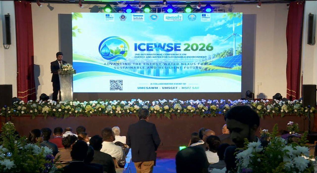
ICEWSE 2026 · 5–6 OCTOBER 2026
2nd International Conference on Energy and Water for Sustainable Environment
University of Moratuwa · Sri Lanka
Online oral presentation Planning for Water Security session
PRESENTED PAPER
A spatial screening framework that separates the ground’s capacity to accept recharge from the availability of floodwater at a candidate site.
01 Can the ground accept water?
02 Can floodwater reach the site?
In collaboration with Abdulaziz Alghazi and Ahmed M. El Kenawy.
Discussion explored field implementation, rainfall-data uncertainty and the next steps from screening to practical application.
Read my conference reflection on LinkedIn ↗SCIENTIFIC COMMUNICATION
Arabic-language educational content connecting GIS concepts with professional practice.
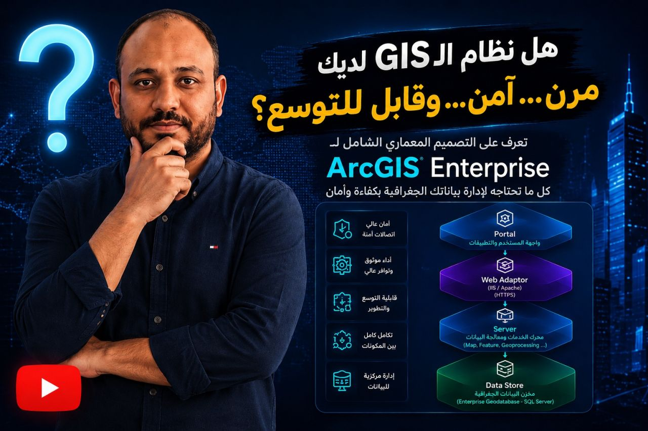
FEATURED VIDEO · ARABIC
هل نظام الـ GIS لديك مرن، آمن، وقابل للتوسع؟
A featured educational video on ArcGIS Enterprise architecture and the components used to organize geospatial services and data.
Enterprise GIS · Architecture · Geospatial data
Watch on YouTube ↗09 / CONTACT
I welcome conversations about research collaboration, geospatial consulting and environmental monitoring.
islammohamed1606@gmail.com